Crater Lake National Park
- Location
- Oregon
- Designation
- National Park
- Entrance fee
- $30 / vehicle
- Track it
- Free in Park'd
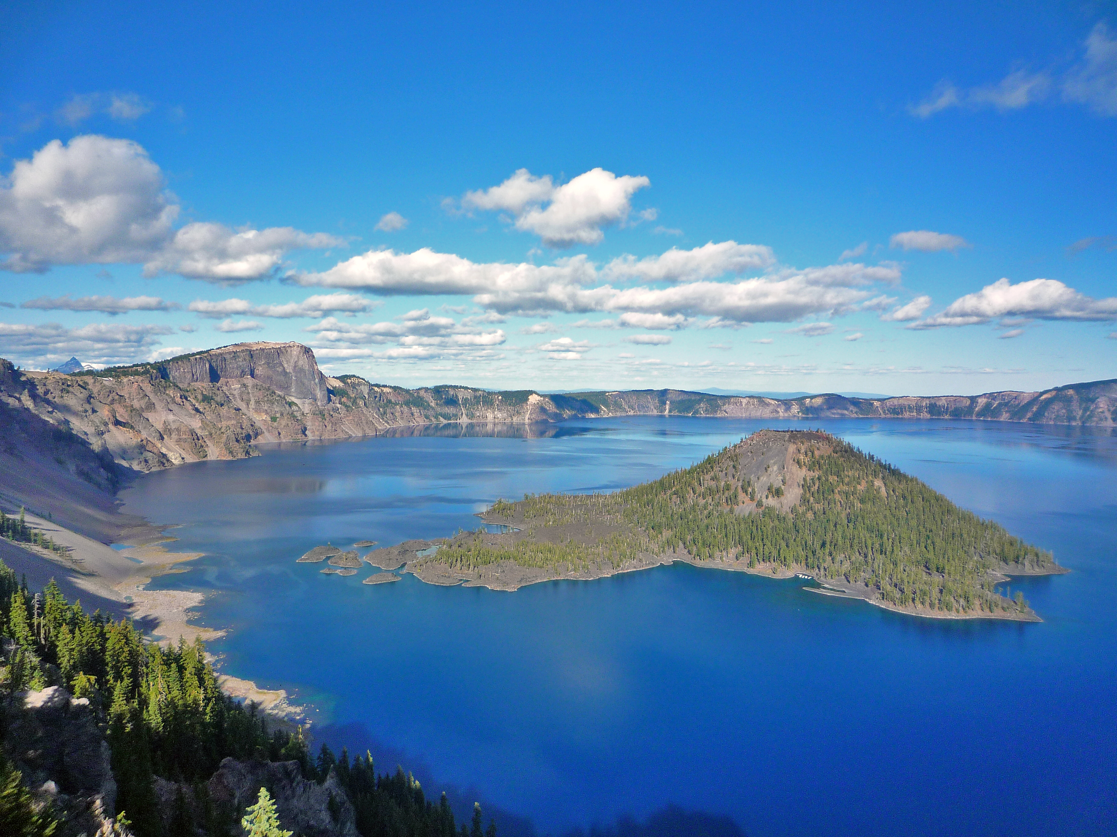
Crater Lake inspires awe. Native Americans witnessed its formation 7,700 years ago, when a violent eruption triggered the collapse of a tall peak. Scientists marvel at its purity—fed by rain and snow, it’s the deepest lake in the USA and one of the most pristine on Earth. Artists, photographers, and sightseers gaze in wonder at its blue water and stunning setting atop the Cascade Mountain Range.
Things to do in Crater Lake
Crater Lake offers a range of activities for visitors in Oregon:
When to visit & weather
July, August, and September are your best bets for warm, dry weather. In May, June, and October, sunny days alternate with periods of rain and snow. Winters at Crater Lake are long and snowy. Storms from the Pacific Ocean dump an annual average of 41 feet (13.5 meters) of snow at park headquarters. When it's raining or snowing, the lake is usually hidden by clouds. Crater Lake is completely invisible about 50% of the time in the winter!
Getting to Crater Lake
From the west (Medford) - Take Hwy 62 to the West Entrance. Open year-round. From the south (Klamath Falls) - Take Hwy 97 north to Hwy 62 to the South Entrance. Open year-round. The North Entrance is on Hwy 138 and is accessed from Interstate 5 east at Roseburg or Hwy 97 south from Bend and Chemult. Winter travelers from Roseburg take Route 138 east to Route 230 south to Route 62 east to the park's west entrance. Travelers from Bend take Route 97 south to Route 62 to the park's south entrance.
Track your visit to Crater Lake
Check Crater Lake off your national parks passport, log the trails you hiked and the wildlife you spotted, and see it on your personal map — free on iPhone with Park'd.

Explore more national parks
Planning a bigger trip? Browse the full list of all 63 US national parks, or keep exploring: